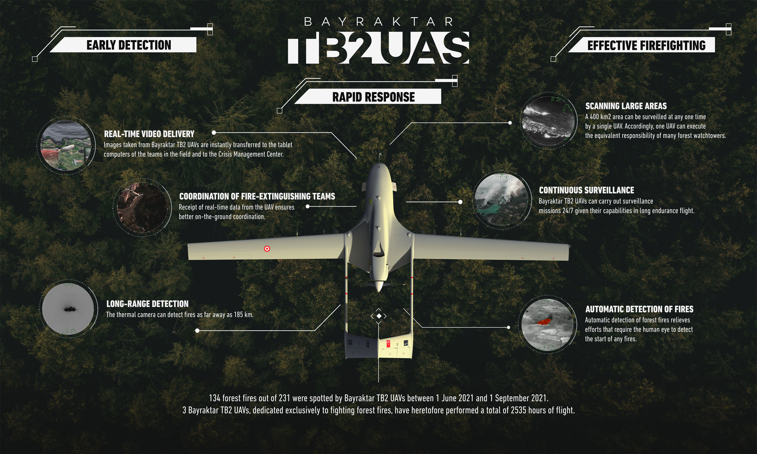


Bayraktar TB2 UAVs, which were developed indigenously by Bayraktar, provide instant live displays and data to Crisis Management Centers and take part in logistics management, traffic regulation, and search and rescue activities in disasters such as earthquakes and floods.
From 2020 onwards, based on the collaboration with the Ministry of Forestry and Agriculture, General Directorate of Forestry, Bayraktar TB2 UAVs, allocated exclusively to fighting against natural disasters, take an active role in early detection of forest fires and managing the fire fighting efforts with efficiency. Thus, for the first time in Europe, high tech UAVs will have been used for fire fighting.
According to data from the General Directorate of Forestry, one TB2 scanned approximately 3.5 million hectares over the summer of 2020 and single-handedly achieved the equivalent of 361 fire watchtowers. With this monitoring, 345 forest fires were detected and extinguished before they spread and covered larger areas.

The innovative solutions pioneered in Turkey to fight fires have continued into 2021. In this context, Bayraktar TB2s serve 3 different headquarters designated by General Directorate of Forestry.
Alongside Bayraktar experts in every center,
Take an active role in firefighting efforts.

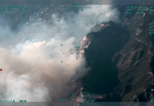
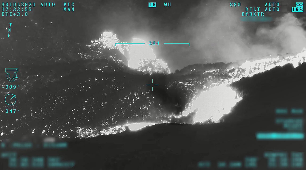
Bayraktar TB2 UAVs can scan 400 km² area at once with a thermal camera. They can furthermore detect fires from a range of 185 kilometers
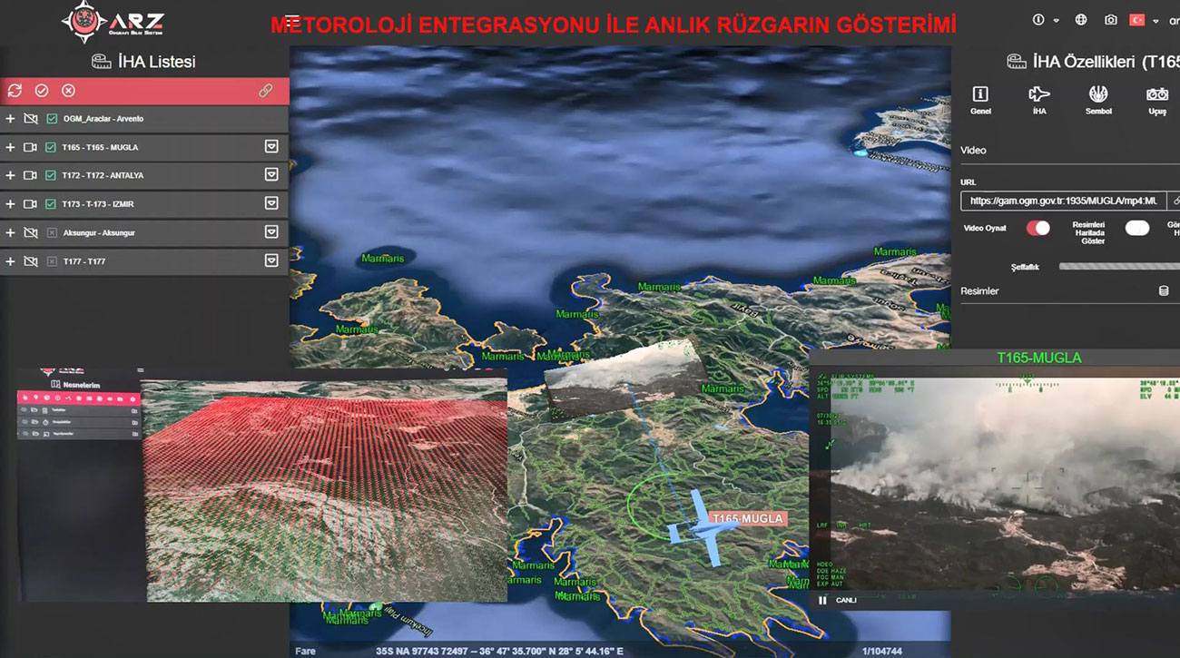
Bayraktar supports the General Directorate of Forestry by offering technology infrastructure for firefighting efforts. With the software and infrastructure established by Bayraktar, realtime display and data transfer is provided to the Fire Management Center of the General Directorate of Forestry in Ankara and to the designated centers with ARZ and KUZGUN systems.
In this context;
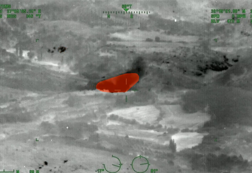
Realtime Fire Detection System with Image Processing
Transfering the images to the Fire Management Center, General Directorate of Forestry and Fire Extinguishing Systems in Ankara
Archiving the images
Tablet usage with the KUZGUN system (For the purpose of transferring images live and instantly to the fire extinguishing teams in the fields via GSM. )
Transmitting the instructions of the Fire Management Center to field teams
Live monitoring of the instant status of firefighting vehicles on the General Directorate of Forestry map and directing them to the fire area
With the analysis of meteorological data, service is provided with software that allows calculating the direction and severity of the fire as a result of instant wind information in the fire area.